How Terria’s 3D Digital Twins Are Transforming Australia’s Spatial Future
Overview
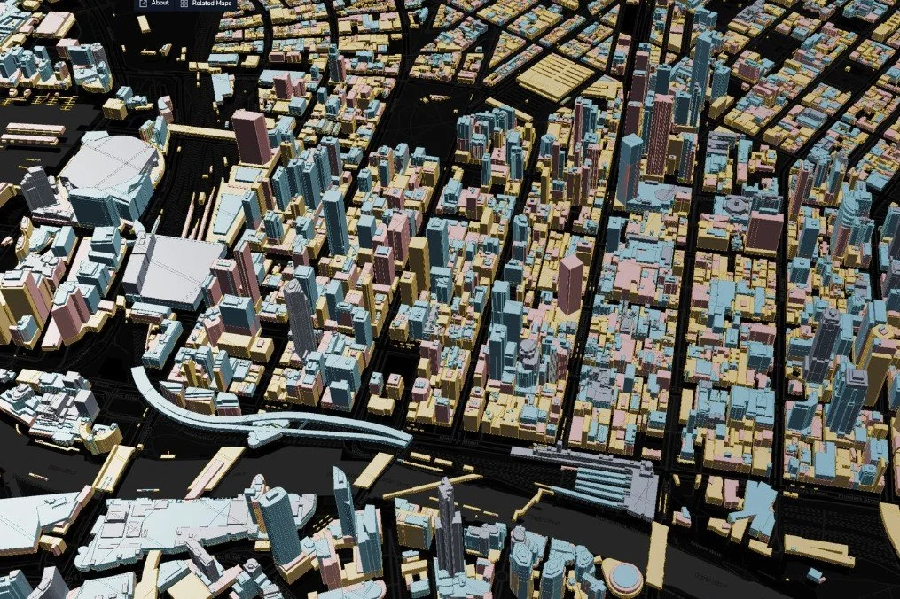
The geospatial landscape in Australia is shifting—literally and digitally. With the launch of Terria, a CSIRO-backed startup, Australia is stepping boldly into the realm of 3D digital twins—real-time, spatially accurate simulations of the physical world. Built on more than 15,000 public datasets, Terria’s open platform is redefining how cities are mapped, monitored, and managed.
From urban planning to ESG reporting, Terria’s spatial engine is fast becoming the foundation for smarter, data-driven decisions.
What Is a Digital Twin?
A digital twin is a dynamic, data-rich virtual representation of a physical environment. In the geospatial domain, this includes:
Buildings, roads, and topography
Utilities and infrastructure
Environmental systems like vegetation and floodplains
Unlike static maps, digital twins are interactive, 3D, and real-time—updated using feeds from satellites, IoT sensors, aerial LiDAR, and open data portals.
What Makes Terria Different?
1. Open Standards, Open Data
Terria builds on open frameworks like CesiumJS, OGC standards, and GeoJSON to deliver scalable spatial models. With a strong focus on transparency and interoperability, the platform makes complex government data truly usable by the public.
2. Massive Data Integration
Over 15,000 public datasets have already been layered into the system—including:
Elevation models from Geoscience Australia
Transport and zoning data from state departments
Climate risk, bushfire zones, and flood models
3. Public-Sector Applications
Terria powers national and state-scale projects like:
NationalMap (Geoscience Australia)
NSW Spatial Digital Twin
South Australian Digital Twin Prototype
These platforms support planners, engineers, and researchers by providing real-time visualisation of infrastructure and environmental assets.
Real-World Use Cases
➤ Urban Planning
Terria’s 3D twins help planners simulate growth, traffic flow, solar access, and building shadows—before a single shovel hits the ground.
➤ Environmental Risk
Authorities use Terria to monitor climate risk, model sea-level rise, and overlay flood maps for mitigation planning.
➤ Energy & Utilities
Integrating grid data with geospatial models supports better asset management and decarbonisation planning for the energy sector.
Why It Matters for Australia
Climate & Resilience: As extreme weather intensifies, digital twins will play a vital role in preparedness and recovery.
Decentralisation: Regional councils can access the same powerful geospatial tools as capital cities.
ESG & Compliance: Visualising impact is now critical—whether it's for biodiversity offsets, Indigenous heritage, or carbon accounting.
Terria is helping put Australia on the global geospatial stage, competing with Europe's INSPIRE program and Singapore’s Virtual Singapore initiative.
Final Thoughts
Terria is more than a mapping tool—it's a spatial operating system for the future. For surveyors, planners, governments, and businesses, now is the time to explore how digital twin technology can elevate visibility, accountability, and foresight across industries.